1

The Expeditions of Zebulon Montgomery Pike, Volume 3 (of 3) To Headwaters of the Mississippi River Through Louisiana Territory, and in New Spain, During the Years — Themes and Context
38
12
Project Gutenberg
2013
Mississippi River -- Description and travel; West (U.S.) -- Description and travel; West (U.S.) -- History -- To 1848; New Mexico -- Description and travel; Pike, Zebulon Montgomery, 1779-1813 -- Travel -- West (U.S.); West (U.S.) -- Discovery and exploration
Readers of public-domain and historical texts
Project Gutenberg digital edition
en
Edition facts
Words: 37,745
Reading time: 165 min
Text sections: 2
Source:
Project Gutenberg record #43776
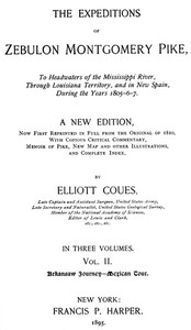
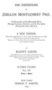
Elliott Coues's 1895 edition of Pike's 1810 narrative, this volume contains the index and maps. The index reveals a dense web of place names, tribal bands, and Spanish colonial terms, while the front matter documents Coues's editorial apparatus and the original cartography.
Editorial Edition Score
4.6/5
★★★★★
★★★★★
Calculated from edition completeness, EPUB availability, text structure and catalogue metadata. Not a user rating.
Edition quality
This third volume of Elliott Coues's 1895 edition of Zebulon Montgomery Pike's expeditions is devoted entirely to the index and maps—a structural choice that foregrounds the editorial labor required to make Pike's 1810 narrative navigable. The index, which Coues states covers "all the matter of the two preceding volumes," is primarily an index of names, both proper and common, without analytical subheadings. Its entries range from individual soldiers like Pvt. H. Menaugh to Sioux place names such as Mde (Lake Pepin) and Spanish administrative terms like Maturrangos. The volume also reproduces six maps from the original Philadelphia edition, including Pike's charts of the Mississippi and the Internal Provinces of New Spain, alongside a new "Historico-Geographical Chart" drawn under Coues's direction.
The Index as a Map of Contact
The index reveals the layered geography of Pike's world. Entries for Native groups—Mdewakantonwan Sioux, Menomonee, Mescalero Apaches—sit alongside Spanish colonial terms like Maturrangos (a derogatory term for mixed-blood Spaniards) and presidio references. The inclusion of linguistic notes, such as the pronunciation guide for Mde ("two syllables, first short, last accented as if Meday´"), signals Coues's attention to indigenous toponymy. The index also documents Pike's personnel: entries for sergeants, privates, and interpreters like Meunier, Pierre (cross-referenced to Archevêque) show the expedition's multinational composition. This is not a simple list but a record of encounter—between languages, jurisdictions, and knowledge systems.
Cartographic Reproductions and Editorial Intervention
The volume's map section reproduces Pike's original charts in facsimile, including the "First Part of Captain Pike's Chart of the Internal Part of Louisiana" and the "Map of the Internal Provinces of New Spain." These are supplemented by a new map drawn under Coues's direction: the "Historico-Geographical Chart of the Upper Mississippi River." The juxtaposition of original and modern cartography highlights the editorial project's dual aim—to preserve Pike's work while correcting and contextualizing it. Coues's own background as a naturalist and editor of Lewis and Clark is evident in the meticulous indexing of geographical features, from Medano Creek to Mesa Prieta, and in the inclusion of modern county and state names (e.g., Meade co., Kas.). The maps thus become artifacts of both early exploration and late-nineteenth-century scholarship.
The Textual Condition: Inconsistencies and Provenance
The front matter reveals the volume's textual history. The transcriber's note states that "inconsistent spelling and hyphenation in the original document have been preserved" while "obvious typographical errors have been corrected." This tension between fidelity and correction runs through the edition. The index itself contains variant spellings—Maupeme, Maupemie, Mausseme are cross-referenced to Mapimi—reflecting the instability of place names in the early republic. The volume's provenance is also documented: it was produced from images provided by the Internet Archive, and the Project Gutenberg credits list multiple proofreaders. This layered production history—from Pike's manuscript to Coues's edition to digital transcription—makes the volume a case study in how exploration narratives are transmitted and transformed.
Readers approaching this volume should treat the index not as a mere finding aid but as a compressed record of Pike's world—its peoples, places, and political boundaries. The maps, reproduced in facsimile, reward close comparison with modern geography. Coues's editorial presence is felt throughout, from the pronunciation guides to the cross-references, making this edition a dialogue between an early-nineteenth-century explorer and a late-nineteenth-century scholar.
Reader reflection
Record your reading impressions
A brief reflection can help important ideas stay with you longer.
Your progress
0
/
10
2
How much did you enjoy the reading experience?
3
Would you encourage someone else to read it?
4
How demanding did the text feel?
5
Could you see yourself revisiting this book?
6
Could you follow the author’s main argument?
7
What was its emotional impact?
8
Did it raise ideas you would like to talk about?
9
What is the main idea you are taking away?
10